Lomtjønnfjellet up by Tuddal

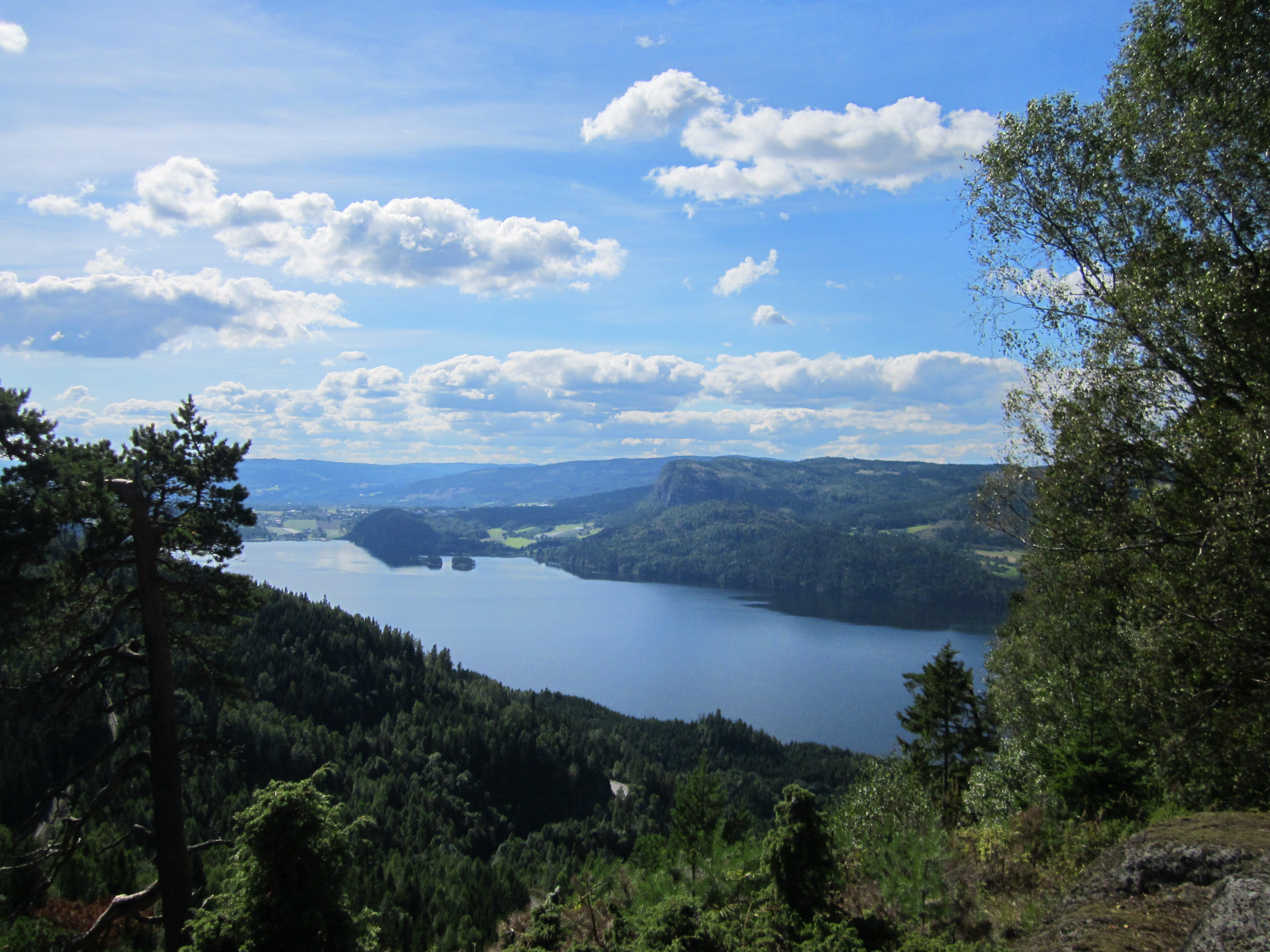
Gaustatoppen and the mighty Gausta massif, seen from way down in Dardalen.

Well now, take a good look at them purdy pictures y’all see here, they’re from the old mountain pastures of Dardalen and another one sittin’ by Ostetjønn, up on the north side of Utmannsnipun near Tuddal. From both them spots, you get yourself a downright amazin’ view lookin’ north toward that mighty Gausta mountain range.
Now them photos showin’ that sweet little lake with the cozy mountain cabins? They were snapped on the north side of Lomtjønnfjellet, which sits at 3,895 feet above sea level, with Lomtjønn itself down in the front at about 2,867 feet.
You can hit the trail startin’ from the parking area over by Sveigtjønn, headin’ on past Dardalen and Ostetjønn, all the way out to Bergetjønn just south of Lomtjønn to reach this spot. But heck, if you’re up for a longer stretch, you can also walk in from the gate down by Stuverud and follow the trail along the Kvitåa river, just keep in mind, that route’s a bit of a haul. Especially if you’re just out for a day trip up to Tuddal from the Oslo area.
Now here’s another fine idea for y’all: hop on a bike and ride out from your cabin stay at Hogstul-hytter, pedal on past Solemstjønn and Kova. There’s a real nice waterfall waitin’ for ya further down by Kroklonin.
When you roll past Kovflottjønn, you’ll see some mighty fine old timber huts standin’ quiet at Kovflott, sure looks like somethin’ outta a cowboy tale.
Keep on ridin’ up along Mydøla creek to the old pasture grounds at Lie and Bismargarden, then up to Nordre Espelie near Gyving, that there’s one heck of a viewpoint. After Gyving, the trail climbs on up past the Gyving Canyon near the Klove Bridge, and then you take a left and follow the path along Kova up to Kovvatnet lake.
From there, you can hoof it over the dam and head out toward Femorklie, Mydalsfjellet, or Sløåtjønnan, all of it through some fine ol’ mountain country on well-worn trails

Now listen here, y’all, you can also hoof it along the north side of Kovvatnet, headin’ on into places like Storehaug, Sandviken, and Kovviken, and even deeper into the backcountry if you got the gumption. And if you’re lookin’ to save some shoe leather, you can drive all the way up to the Kov Dam, just be ready to cough up a toll comin’ in from Stuverud.
Now, if you done spent the night in Tuddal, you’ll have plenty of time to get yourself a good ways in, past Kovviken, up through Husbreihaugan, and climbin’ past both South and North Risbua. You might even make it down through Upper and Lower Kovedalen if you’re feelin’ spry.
Or heck, after them Risbua cabins, keep on truckin’ past Steinselet and further up by Lauvhovd, Øvrestul, Helleksdalen, Nystul, and then swing down to the road near Bonsvatn. There’s more campin’ spots out here than ants at a summer picnic, especially up ‘round them old pasture clearings I been talkin’ ‘bout.
And if you pitch your tent somewhere ‘tween Kovedalsnuten and South Risbua, you’ll be sittin’ real pretty for a solid day hike up toward Lomtjønnfjellet and Damlifjellet, passin’ by Kroktjønan on the way. It ain’t too hard a climb if the weather’s fair and your boots are holdin’ up.
You can also head on from them Risbua cabins down toward Bonsvatn by way of Gunnarburoe and Finnvollen, just hang a right when you hit the road by that old pasture or the place they call Gammen.
Now if you’re stayin’ at Hogstul-hytter, you might like takin’ the ol’ Prestvegen, that one’s real easy on the knees, good for the older folks or anyone who ain’t lookin’ to hike up and down like a mountain goat.
MAP OF TUDDAL:


(Lomtjønn, with them old mountain pastures layin’ in the background.)


(Ostetjønnseter, with two curious ol’ sheep starin’ like they own the place.)

(Femorklie biggest darn summer farm ‘round these parts. Plenty o’ good parkin’ close by, too.)

(View lookin’ west over Kovvatnet from up at Femorklie. See them mountains in the back? There’s a trail runs down from there — follow it, and it’ll take ya)


(Kovflott)

 (Nordre Espelie)

(The Lie seter — mighty fine view, and sheep grazin’ like they got nothin’ but time.)


(A waterfall along the Kovva River)


Kommentarer
Legg inn en kommentar