Røstvet Mountain, Langmyra Nature Reserve, Nordfjord Cabin, Isi and Enli Nature Reserves!

(The Lookout Point and Campsite, Røstvet Mountain)

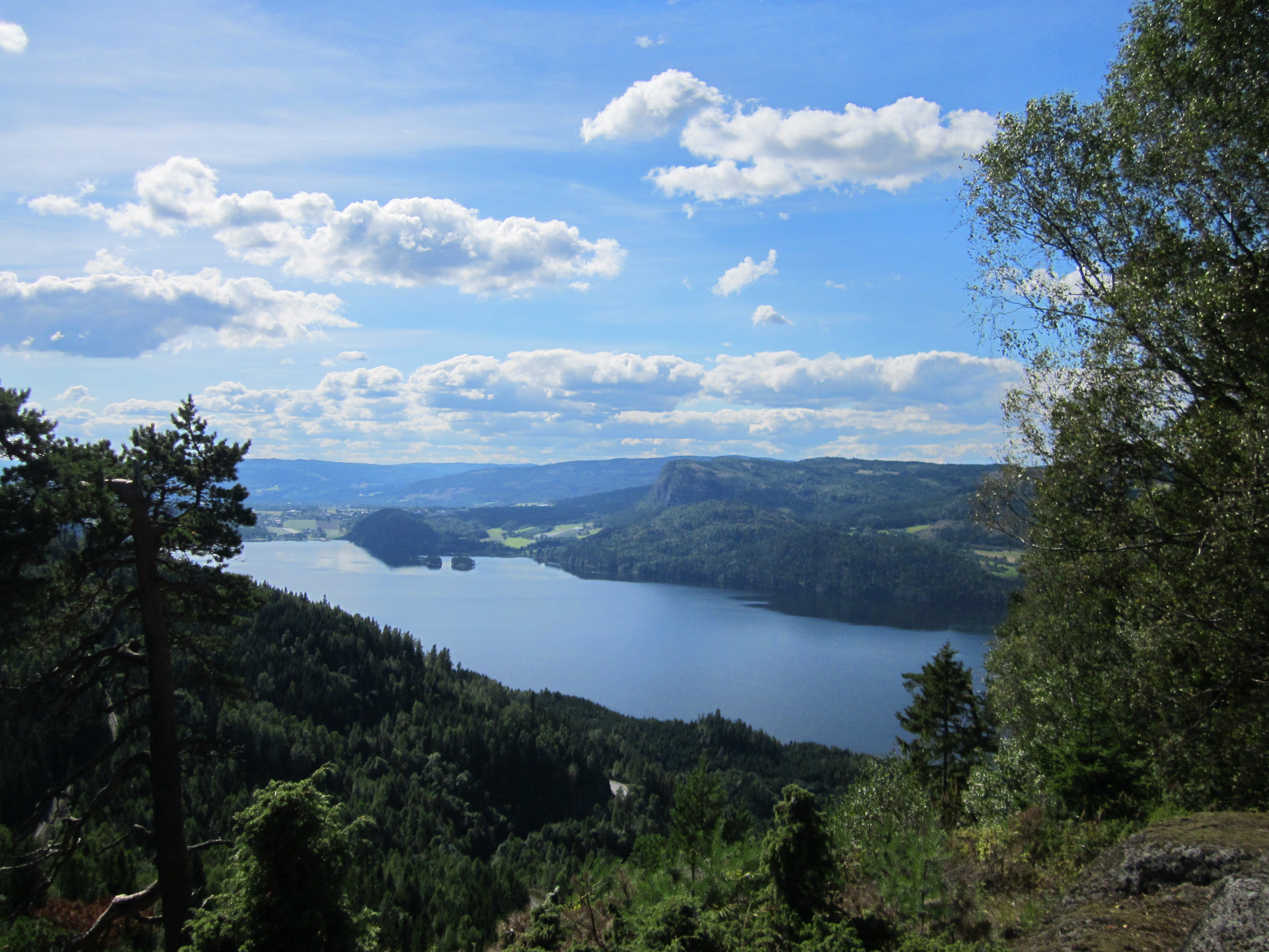
Røstvet Mountain
In the pictures above, you see a magnificent viewpoint at Røstvet Mountain, just south of Langemyr and Hujonfjellet, and right above the Isi landfill in Bærum.
So even though the picture gives the impression of being deep in the wildest wilderness, it's actually taken right near the most densely populated area of Bærum, namely my hometown, Rykkinn.
So here you have a local treasure where it's perfect to pitch a tent - but watch out for the adder, which also thrives well in an idyllic and sunny spot like this.
Below, you'll see the map that takes you up to Røstvet Mountain, and if you're lucky, you might even spot a lynx as they've been observed several times in the area.

Here's how to find your way:


.png)


It's also possible to get there from Rykkinn. Just before a hilltop on the downhill side of a field, take a right onto a muddy four-wheel-drive road, which you'll recognize by its frequent maintenance with gravel and sawdust, both in winter and summer.
Then you'll arrive at a lovely smallholding with a huge twenty-year-old Toyota Land Cruiser in the yard, which has clearly been well taken care of by some rainbow guys. These same rainbow guys have a rainbow flag in their yard, hence the name "rainbow guys."
Continuing past the smallholding, where the tractor road starts with a sharp right turn, take the first tractor trail to the left. This is marked in red on the map.
After a couple of kilometers, about 1500-2000 meters, you'll reach a clearcut area with lots of wild garlic. Here, the tractor road snakes back and forth (see the comparable map with arrows marking where the trail is drawn on the map).
Isi and Enli Nature Reserve:

Map of the area from 1991, the so-called Gommerud map. (P.S.: The trail all the way to the left, marked by me with a green marker, is now cleared all the way up to the blue-marked trail much further above, where this trail and map end.) Here, you'd rather head up towards Solfjellsstua and Nordfjordhytta, along a clear tractor path. When you reach a point where the DNT (The Norwegian Trekking Association) and Rykkin's neighborhood association's cultural trail approximately begins, on a marsh with a lot of fill material of coarse stone, follow what you see on the map above, marked in purple. Here, the trail continues up to Nordfjordhytta on a great route with lots of beautiful nature. While you walk this trail, instead of turning right, continue straight ahead. Here, you can also turn left, towards a hill with a great view. The pink stippling shows approximately where you can go to find this viewpoint.


Kommentarer
Legg inn en kommentar