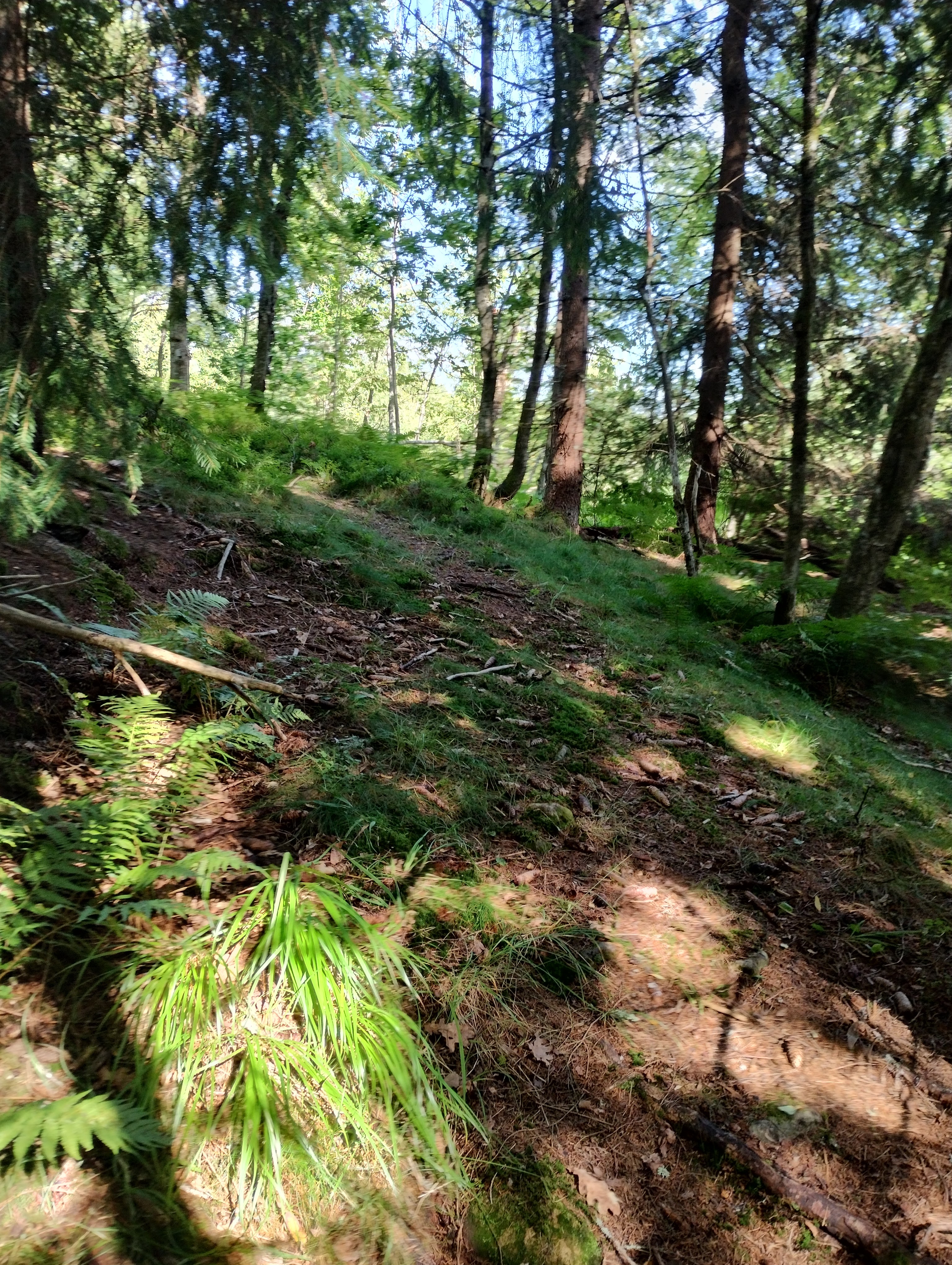
Emma Hjorth, Ramsåsen loop through Tanum Jordbru.

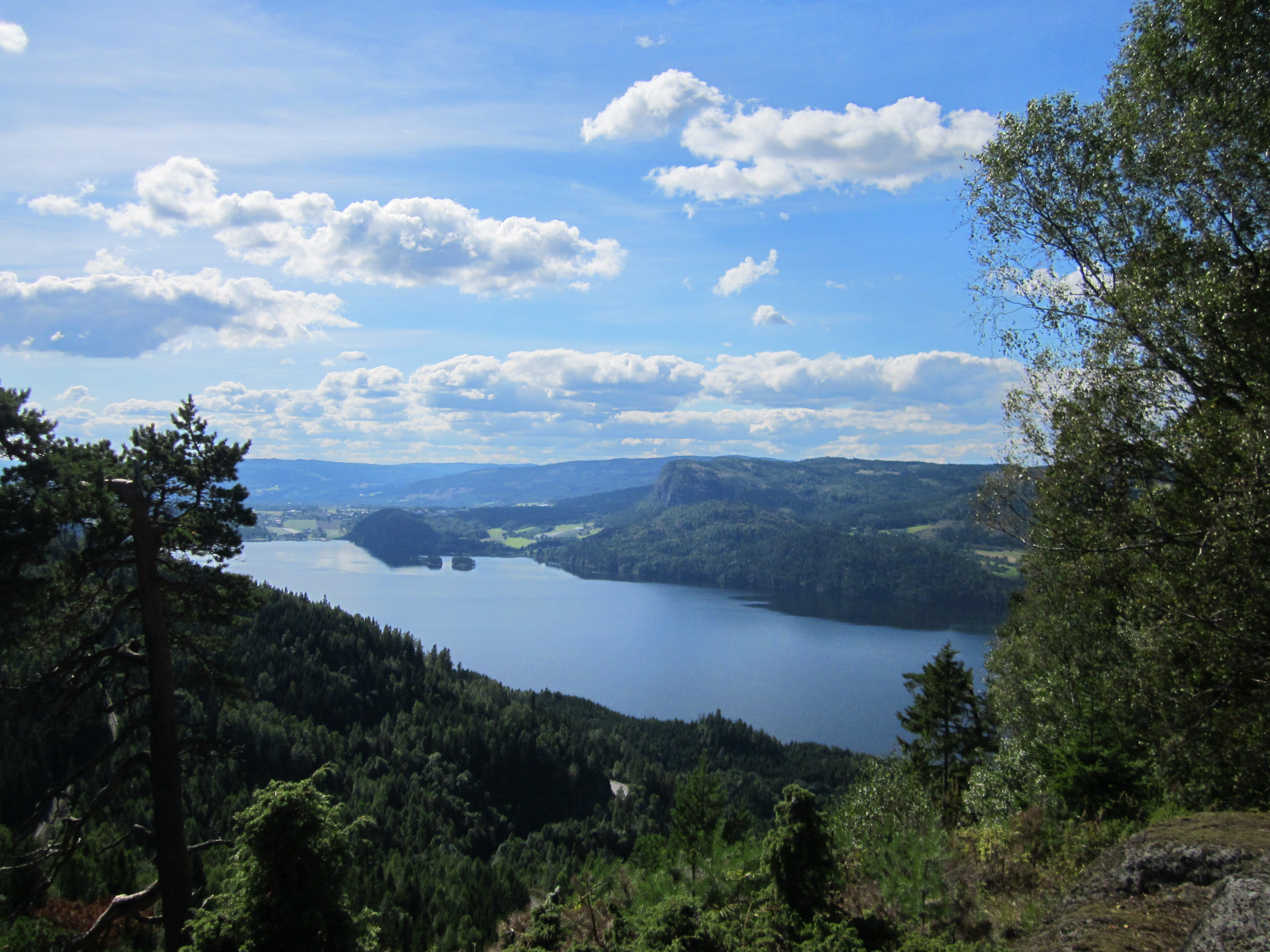
Up at Ramsåsen lookout point. It's like bein' at the top of Holmenkollen ski jump and Tryvann Tower—like you're in heaven!
The hike heads to Emma Hjorth through Tokerud view to Tanum Church (famous for Alex Rosen's big embarrassment). From there to Ringi Farm, known for its darn good exclusive apple cider and pick-your-own corn in beautiful countryside.
Then on to Ringi Hill where the trail ain't marked and turns right from the blue-marked trail just past the cornfield at Ringi Farm, with some bee hives and an old rundown pasture.
Up on Ringi Hill, there's a mighty fine view and a dang good nature reserve worth visitin'.
Next, past Jordbru via an old stone hut used by Milorg during World War II, then up to Ramsåsen via Kantebakk, and possibly another Milorg cabin called Ramsåsstua.
From there, head north to Skosliteren through Tjennhaugputten, and either Merradalen or Langås Cabin—also used by Milorg—and further on to Skosliteren and Peterskleiv.
At Skosliteren, hot-headed Peder Ringeneie reportedly axed his wife Anne Larsdatter in late November 1846 while she was on her way to Jammerdal to fetch their kids from Grandma's, when Peder was supposed to be choppin' firewood for winter but clearly had other plans. Peder Ringeneie was the last person sentenced to death by axe in Norway, with a bloodthirsty crowd watchin'."
Ramsåsview

You can also go through Svartvann Cabin, now a DNT cabin with a swimmin' spot and nearby bathin' opportunities at Svartvann. You can chill there a bit, maybe even stay overnight and recharge for a longer hike the next day.
From Røverkulåsen and Skosliteren, you can head on to Skui through Jordbru to catch the bus. Here are four options:
You can cross the field right behind Skui ski jump and take the unmarked trail down Urdselva to the bus stop. (BUT REMEMBER, YOU'RE ON YOUR OWN HERE, 'CAUSE PARTS OF THE TRAIL HAVE SLID OUT AT THE BOTTOM, SO YOU GOTTA GO AROUND ON THE UPPER SIDE!)
Take the gravel road to the left of the ski jump and head down to the right to the bus stop just before you reach one of the houses.
Head left between the field and the gravel road to the houses just north of Skui ski jump. (BUT REMEMBER, IT'S BETWEEN THE FIELD AND THE GRAVEL ROAD, AND YOU'RE ALSO COMIN' DOWN WHERE THERE'S BEEN A SLIDE. SO REMEMBER, TRAVEL AT YOUR OWN RISK.)
Take the road past Skui ski jump between the top and bottom ends, and when you reach a parkin' lot, you can choose to go down the ski trail right below the parkin' lot and further down past Skui school. Then catch the bus from the school or just have someone pick you up by car at the parkin' lot.
Or...
You can also take an old road right below Ramsås cliffs. Maybe get picked up by some friends in a car at Jordbru parkin' lot. If you've gathered up enough strength and stayed overnight at Svartvann Cabin, you could also head further from Jordbru over Ringi Hill and either catch the bus from the south side of Ringi Hill, or maybe head on to Tanum Church and get picked up by car there, or continue on to Emma Hjorth, where I first mentioned startin' this journey. Or head south to either Tanum school or Øvre Ås farm. At Ås farm, you can also continue on to the Scouts' secondhand store, which is a darn good thrift shop at Tanum.


.png)
Suggested Hikes in the Area
1. Ramsåsen and Ramsåsutsikten from Vestmarksetra through Haugsvollen
2. Urdselva ascent
3. Urdselva and Mærradalen ascent
4. Kattåsen and Eikelundshøgda through Eikelundsraset
5. Tanumskogen loop including the thrift store
6. Svartoråsen, possibly incorporating parts of Urdselva and Ringiåsen to the bus stop at the southern side of Ringiåsen.
Ramsåsen and Ramsåsutsikten from Vestmarksetra through Haugsvollen
This here hike is easier than goin' up from Jordbru to Ramsåsutsikten. Especially if you ain't lookin' to tackle them real steep parts up Kantebakk, and ain't thinkin' you're some hotshot in your 20s or 30s doin' interval training up there. Kinda like them fit folks runnin' up and down South Kolsås Peak. The trail from Vestmarksetra is a lot gentler and more kid-friendly. You start from the upper parkin' lot and follow the blue-marked trail via the ski track towards Grønland. Once you're in the woods past the bare ski track onto Grønlandsveien gravel road, you'll come to a mighty fine rock that kids'd love to climb on and feel like kings of the hill.
You could also reach this rock comin' from the old blue markings from the middle or lower parkin' lot. After the rock, you continue flat on the road a short piece before turnin' right onto a road down and over a bridge leadin' into Haugsvollen—where Peder Ringieie and Anne Larsdatter lived back in the 1840s. You can also head through Eikelundshøgda from Haugsvollen, and all the trails via this ridge I mentioned in point 4 about these hikes.
Further from Haugsvollen, you can go straight up a trail above the ruins or up the old ski track or today's blue-marked trail farther down towards Kattås. As you go up, remember to follow the old ski track or turn right from today's blue-marked trail. As the old ski track climbs left, you'll come to a spot where you can choose a path right over a creek with lots of willow shrubs.
You can also keep goin' up towards another rock for kids where a trail goes left a little later. Followin' that first left trail leads you to a splendid viewpoint. The trail follows the ridge outermost but ain't too airy 'cause there's lots of trees in the way.
Further along the ridge, the trail from the rock joins in. You keep goin' past a rain pond and come to a ridge on a rock face. All fired up headin' towards Ramsåsen. Maybe you're talkin' and not payin' attention, but all of a sudden you see a chimney straight up from the rock/ridge, and you think, "Well, what's this chimney doin'...?" But then you see the outline of a whole cabin under the rock, and durn if there ain't a Milorg cabin up on Ramsåsen too? Further past the Milorg cabin, you reach the trail takin' you right to Ramsåsutsikten. Enjoy your hike!
P.S. You can also pass a great big charcoal mound above the second rock you come to in the description. You can also pass Stovivollen and Rolighølet. If you're in a rush headin' back, I recommend goin' to Stovivollen and then straight down the road back to the parkin' lot. But then you'd miss Rolighølet, which lies along the blue-marked trail on the other side of the creek and valley.
Urdselva Up
Take the bus to the end stop near the old Isi exit along the old E16. Walk 'bout 20 meters north from the end stop. Here, the walkway crosses a little river/big streambed that turns out to be Urdselva. There's a small gravel road goin' up to two houses where it's easy to pass on up to a tractor road goin' real steep up along the falls on the lower end of Urdselva.
In the first turn to the right, there's a little ledge startin' to grow back. There's a trail trodden up along Urdselva here. It's a bit overgrown, but I've trodden tracks up myself.
You follow the trail from the ledge down where the tractor path's built into a cliff along Elvekløften. There's some timber blocks you'll have to step over. After you've stepped over some timber blocks to the bottom of the hill from the tractor road, you'll see the path goin' diagonally up to the right. It's real unclear. WARNING, LAST TIME I WALKED HERE, IT SLIPPED. I WOULDN'T GO UP. BETTER GO 'ROUND TO THE RIGHT.
After you've walked to the right, you'll have to try and go down the trail farther south up Bekkedraget. The trail has some obvious but overgrown wheel tracks in some clayish mire with ferns. After some hundred meters, the river snakes back and forth to the left. There's a wide open spot/meadow where you can set up camp.
If you're free Friday night, go to the bus stop around 19:00 or closer to 21:00. You can still get in here to camp 'tween 22:00 and 23:00 early Saturday. You can cross the river mornin' after, if you camped first. Go up to a field right behind the Skui ski jump. It's safe to walk across summer because open grazing land isn't fenced like cornfields. Right across the field, walk the blue-marked road right. When you've gone a piece off the road, follow signs up Skosliteren to Svartvann. Here by Svartvann, you'll have come to Urdselva's start. Now, walk right down to the bus and Urdselva's end.

Urdselva Up Mærradalen (Ramsåsen's Answer to Mørkgonga)
Here you go the same way up Urdselva until you reach the cross at the gravel road at Jordbru behind Skui ski jump. Here, you can choose between goin' up Skosliteren or continuin' on the gravel road towards the parking lot with the biathlon arena and shootin' range at Jordbru south. So, you're goin' only about 100-200 meters south in the direction of the gravel road towards Jordbru south. You'll pass a small clump of old spruce forest. Here, you take a right over or through a gate up a tractor path goin' up to the blue-marked winter road. Right 'round the same spot, the passage up Steinura goes up to the so-called Mærradalen (kinda like Mørkgonga). You gotta find this passage up Steinura yourself. 'Cause it ain't a trail neither on the map nor in reality. (WARNING, BE CAREFUL AND WATCH OUT FOR LOOSE STONES. THERE COULD ALSO BE A FEW VIPERS HERE).
Once you get up to Mærradalen, you gotta decide if it's even possible to go up here. I ain't never gone up here myself, and I ain't never heard of anyone else doin' it either. But I sure have gone up Steinura to look at this Mærradalen once. The main thing here is there's a lot of slippery earth, so it might not be doable 'cause it's too risky. 'Cause you can't get a grip (sure, a few small trees clingin' on, but it might be too risky for it). An alternative could be if some real climbin' experts went up and secured a rope here. WARNING HERE TOO, TRAVEL AT YOUR OWN RISK. I AIN'T REALLY HEARD OF ANYONE GOIN' UP HERE.

Tanum Skogen Rundt via Bruktbutikk
This route can be started from both Emma Arbeidssenter near Emma Cafe, or from Åses vei at the northern end of Emma Hjorth, close to Kirkerudbakken. From Åses vei, you walk up Haugkleiva and past the power line, then turn left downhill past the field and into the forest, passing a burial mound and some small hills. You'll arrive at a magnificent viewpoint in this area just below the trail. There are also some intriguing limestone quarries here from old times. Continuing onward, you descend to the lower side of Tanum Cemetery, where you have a wide and beautiful view towards the city.
After this, you enter Kirkeveien on the southwest side of the church. As you descend to a crossroads where Kirkeveien slopes downward to the right, you have the option to go straight or turn left. If you turn left, you descend to where the trail goes down to Emma Hjorth, where you can also start the hike. You head left towards Emma Hjorth and then immediately right towards Tokerudutsikten. You can also access Tokerudutsikten by going straight from Emma Arbeidssenter near Emma Cafe, past the pump house, and then left towards Tokerudutsikten. At Tokerudutsikten, there's a natural stone table with benches shaped by time where you can marvel at the splendid views towards Fornebu, Oslo, Ullernåsen, Bærum Hospital, Kolsås Toppen, and much more.
When you leave here, you can return either via the route you came from Tanum Kirke and Åses vei/Haugkleiva, or continue straight and diagonally right over a hill to a nice viewpoint towards Skaugumsåsen and a field where you can see deer at sunset. Eventually, you return to Kirkeveien where you initially pass by a frog pond, rainwater dam/ice dam, and then turn left. If you return to where you came from, you go down to the frog pond through a logging area with splendid views. From here at the frog pond, you continue on Kirkeveien past a magnificent apple orchard and an old farmstead, then further down to the school roundabout and past Kvikkhytta, a cabin owned by the 1st Tanum and Jongsspeiderne. From here, you can also take many other hikes or detours, either via the south side of the field or simply via some hills that branch off from the school.
When you reach Kvikkhytta, there are several nice viewpoints both at Kvikkhytta itself (if you walk out there) and just past Kvikkhytta, at least one. Right after the viewpoint on the trail just past Kvikkhytta, you descend a rather steep path straight down to Øvre Ås gård. It's worth noting that before you go down this trail, you can also walk a bit further to another very splendid viewpoint that's worth the trip as a shortcut from Tokerudutsikten, especially if you're starting from Åses vei. When you arrive at Øvre Ås gård, you take the gravel road up to Tanumveien, then down the walkway and into Old Tanumvei to Speiderens Gjenbruk at Tanum. You can go in here, browse around, and then continue down to Vågebytoppen Barnehage, where you turn left into a very inconspicuous hiking trail between a Swiss villa and then down, crossing Vågebyveien and then continuing extra steeply down to Åssletta. Past a yellow house, you turn right onto a hiking trail that follows along the power line and then up the road past the clubhouse of the local sports club, Tanum Jardar IL. From here, you can either turn right over the field and then left onto the trails up to Emma Hjorth, or continue straight past the daycare center at the end of this cul-de-sac and then up towards Emma Hjorth.


3. From the bus stop at Kattås, head towards Kattåsen and Eikelundshøgda via Eikelundsraset.
Startin' at the bus stop, which also doubles as a parkin' lot for cars, take the blue-marked trail that follows the road and power lines up to Vestmarksetra. Once the trail veers away from the power lines and briefly alongside the road, you'll want to take the second or third trail (the third one's only on the 1989 map from IL Tyrving) to the right after the trail's been following the north end/top of the power lines for a bit. Both trails (one of 'em's a road) lead up to some cabins. After passin' the cabins, you can choose to go right up to the lookout point or left to the smaller peak. Then you'll need to see if there's a way down to the trail on the north side of Kattåsen. Even though I know Vestmarka like the back of my hand, Kattåsen's been somethin' I ain't been much, so I ain't sure 'bout goin' down here. If ya do go down, the best bet might be through the middle ravine, or possibly diagonally down through the north side of the peak and lookout. If ya come down from the north side, you'll hit a trail that might not've been used since the '90s. Followin' that '90s trail'll getcha down safe to the pump station at Kattås. The 1989 map doesn't clearly mark the pump station, just a nice marsh, a little Vårdam, and a creek. From there, head south up Eikelundsraset to the power line at Vestmarksetra.
Once ya reach the power line at Vestmarksetra, the view towards town's mighty fine. Follow the gravel-covered four-wheel drive road goin' up, not sure if it starts right at the ski trail or a bit further up. When ya hit the second sharp left on this zigzag road, take a right onto a tractor trail into a new clearin' full of raspberry bushes. Note, the trail was still clear by late July last year.
Continue into the woods on an old road that's held up real good, considerin' what happened in winter 2020-2021. Head up right where the really old road veers left. As ya go up right, you'll start seein' a bit of a view and come across a half-collapsed cabin/ruin from the interwar period. Enjoy the view and pick some blueberries, maybe after ya've already picked some raspberries back by the four-wheel drive road. Then head north past the top of the cabin where the old road's runnin' behind it on the west side. Eventually, ya'll come to a new clearin' not on the 1990s map. So, ya gotta be patient 'cause it's real tough goin'. Last time I was here, I had to turn 'round 'cause I was runnin' outta time.
When you're at the clearin', ya got a choice. Ya can bushwhack up to Ringenhytta and take the trail down the northwest side. It's held up fine over the years and still in good shape. Or, ya can take the two trails from the '90s on the northeast side of Ringenhytta. The one on the right from the clearin' heads straight down towards the pump station, a good option if ya believe in ghosts, 'cause the left one joins the popular route to Haugsvollen. Peder Ringieie supposedly lived there with Anne Larsdatter, who he killed on the way down Skosliteren on the other side of Ramsåsen in November 1846. Supposedly, Peder Ringieie got himself killed too. They hung or chopped his head off on Jongsåsen in October 1847.
After headin' right past the raspberry spot towards the dilapidated cabin, take a left onto a trail that splits left from the four-wheel drive road right where the first cabin shows up goin' up this way. Along the contour, follow the trail left; there's a few ghost cabins 'round here too. When ya come down near where the old blue-marked trail heads towards Haugsvollen, where there's also a cabin, head up right towards Ringenhytta. Ringenhytta's worth a look; it's a real nice cabin with a mighty fine view. Once ya're down at Haugsvollen, just follow the blue markings down towards the pump station at Kattås, and from there, the road and trail back down to the bus stop parkin' lot at Kattås, and then home.
P.S. You can also take the bushwhack trail out to the cabin near Eikelundsraset, right by where the four-wheel drive road heads up from the ski trail, just for a little extra poke around.

(The author in full sprint downhill towards Haugsvollen, taking the shortcut over Eikelundshøgda

Information sign from DNT, right by the unmarked trail where the path to Eikelundshøgda goes.

"Info 'bout them woods in Bærum where that shortcut over Eikelundshøgda cuts through?"

(Ringenhytta)

The arrow indicates where the trail begins/ends.


Here's a fixer-upper with a chimney and an outhouse, plus a solid foundation.


Stunnin' views from all livin' spaces, perfect for catchin' the last breath of the sun.

Plus assorted furnishings.


(The trail over Eikelundshøgda as it looks above the cabin ruin.)

 (I took a hike on that trail, whoops! What's stickin' up from the ground over there?)
 (The Milorg cabin at Ramsåsen.)


.jpg)


Kommentarer
Legg inn en kommentar